CMS Data
Data Types
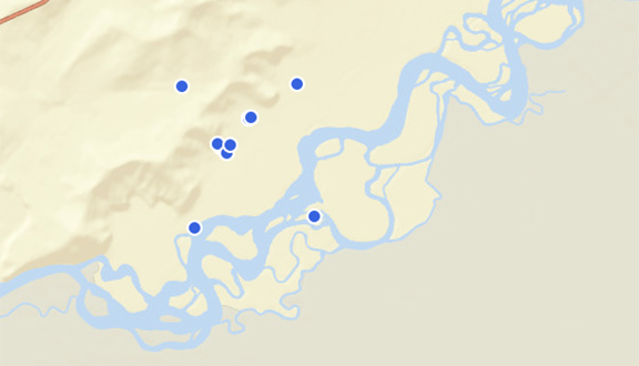
Point Data
Information about locations or points of interest can be used to determine events, emissions, changes through time or field data that is specific to a location on the ground. These data are critical for creating, calibrating and interpreting carbon monitoring datasets.
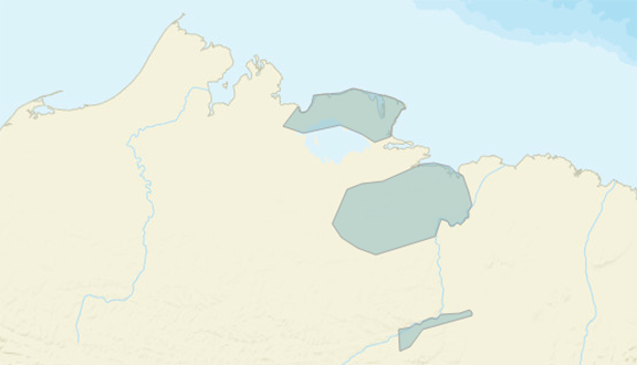
Shapefile Data
This data type provides an outline or boundary data that can be overlaid on a map to facilitate geospatial analysis. Shapefiles are simple vector data that is commonly used in Geographic Information Systems.
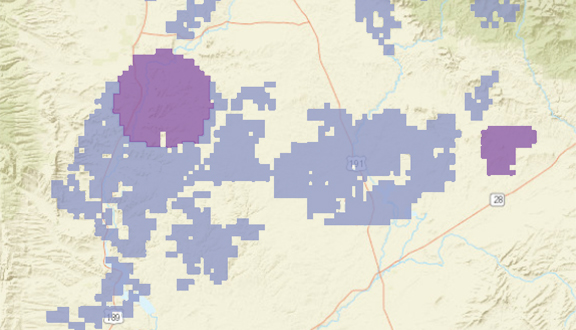
Grid Data
Environmental map data is stored in a grid format, which provides information about geographic space in a grid. The format allows for describing environmental and spatial information in a regular format which can be compared across space and time.
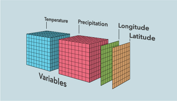
Multi-Dimensional Data
The Common Data Format (CDF) is based on user-defined parameters and allows for efficient data storage of datasets with multiple, irregular dimensions. The CDF structure is based on variable definitions and allows one to define an unlimited number of variables that are completely independent of one another.
About CMS Data
Scientists funded under the CMS project are focused on providing new datasets usable by partners, stakeholders and decision makers working on climate adaptation and mitigation. The initial emphasis of the program was on regional, national, and global satellite-based carbon monitoring products derived from biophysical models and analysis. The result is that the majority of CMS data products are available in grid or complex multidimensional format and are either continental or global in scale. These datasets are ingested into models, which are three-dimensional mathematic representations of a process or system, whose objective is to predict or explain how the elements relate to each other or are changing.
Models require a great deal of training and validation data to develop and implement. CMS therefore funds field work where scientists measure elements directly to ensure their model representation of the information is correct in space and time. For example, the United States Forest Inventory and Analysis (FIA) system requires information on the height and size of trees in the field at a specific time. These data are then connected to highly accurate latitude and longitude locations to create ‘point’ data. The point data are then ingested into models to create maps of forest biomass.