Water
Success Stories
Coastal Wetlands
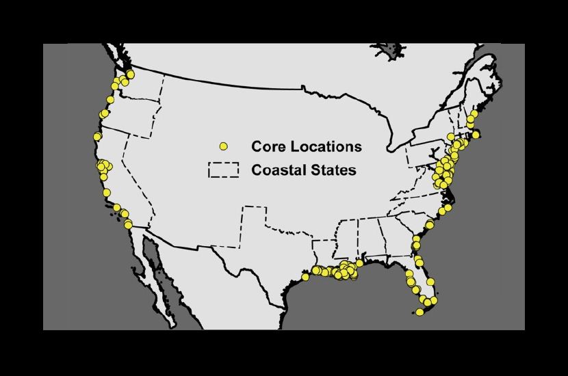
Coastal wetlands provide a wide range of societal benefits, including protection against storms and sea level rise across large, highly populated areas and sequestering carbon. NASA CMS project (Holmquist CMS2011) produced a map of the spatial distribution and magnitude of the soil organic carbon in coastal wetlands using a model based on the simplest strategy possible, Holmquist was able to create spatially continuous maps of wetland soil organic carbon for the top meter of soil, concluding that there is approximately 27.0 kg of carbon per cubic meter in wetlands along the US coast.
For carbon accounting purposes, accurate and precise information on the magnitude and spatial distribution of wetland stocks around the coast and inland United States. This project focuses on creating a model that can connect satellite remote sensing and ground data to estimate the total carbon stocks available in wetlands.
Gulf of Maine
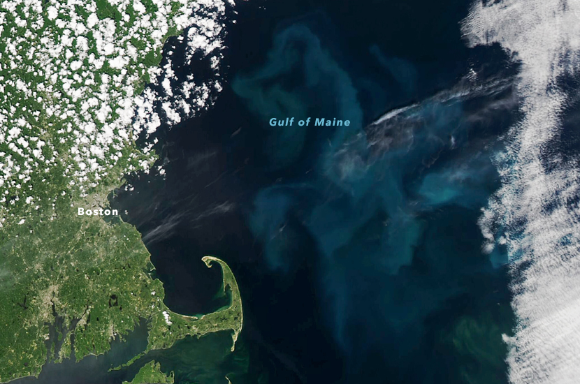
The Gulf of Maine is the source of New England’s marine ecosystems and economy. Phytoplankton that occur in the top layers of the ocean water is a food source for the region’s fisheries. Changes in phytoplankton productivity is caused by changes in carbon flowing through the marine food web and is driven by sea surface temperature. Mitchell (Mitchell CMS2018) has produced maps of phytoplankton using satellite remote sensing of ocean color and sea surface temperatures, observations from ships and buoys to track changes in phytoplankton density and to predict harmful algal blooms.
The model is based on the Gulf of Maine North Atlantic Time Series (GNATS), a 23-year sampling program of the temperature, salinity, chemical, biological and optical measurements of the gulf. The GNATS dataset ultimately will compare changes observed directly on the gulf’s surface waters to observations by Terra, Aqua and other NASA satellites acquiring ocean color data. The measurements complement satellite observations from space that can sometimes be impeded by cloud cover.
Carbon Sequestration in Freshwater Lakes
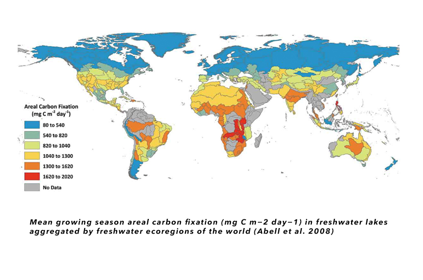
Carbon sequestration in freshwater lakes around the world was quantified using a new satellite remote sensing system to identify global freshwater lakes and ponds. Using a depth-integrated model, a light utilization index was derived that could quantify the health of these ecosystems and how they are changing over time (Sayers CMS2016). Traditional field methods for measuring and monitoring primary production are unable to capture the necessary spatial and temporal variability at the global scale due to the sheer number and diversity of the world’s lakes.
Satellite remote sensing offers a potential tool to quantify freshwater lake primary production on a global scale. A new straightforward remote sensing approach was developed to estimate global freshwater carbon fixation from satellite observable lakes using a straightforward depth-integrated model (DIM) and has been applied globally to improve our understanding of the impact of fresh water carbon balance on global greenhouse gas emission budgets.